I’m sorry to see Canada getting hit by yet another big fire and smoke season. Hang in there, friends. We’re burning down here in the northwest US, too.
Our satellite imagery of fires is pretty impressive. So impressive, that last week it told me that half my city was on fire when it turned out to be the off-gassing fire at the sewage treatment plant.
You are not logged in. However you can subscribe from another Fediverse account, for example Lemmy or Mastodon. To do this, paste the following into the search field of your instance: !canada@lemmy.ca
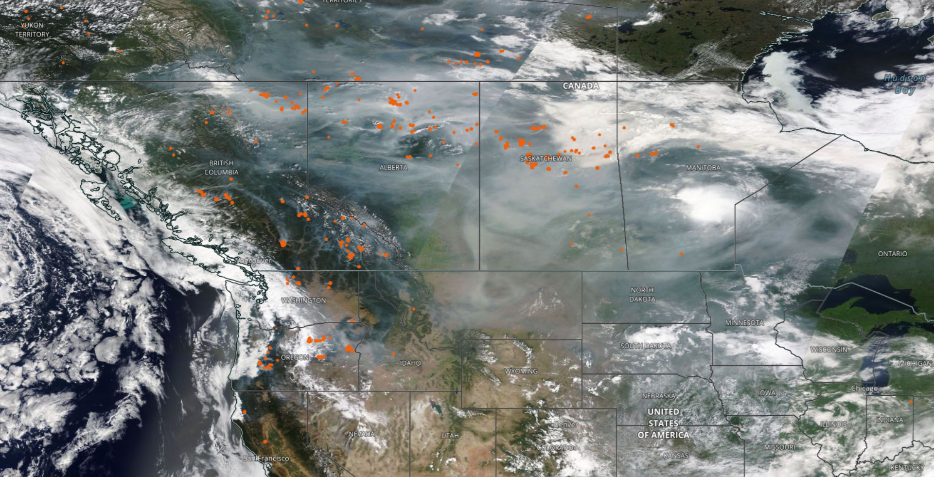


Our satellite imagery of fires is pretty impressive. So impressive, that last week it told me that half my city was on fire when it turned out to be the off-gassing fire at the sewage treatment plant.
see also: https://firesmoke.ca/forecasts/current/
Ooooh, that’s a sweet map!
Another map source for wildfires in Canada: https://cwfis.cfs.nrcan.gc.ca/interactive-map
That’s a sweet map, too!