it’s been a while since my last post. Since then - with the help of this awesome community - I have added multiple new features and fixed a lot of bugs.
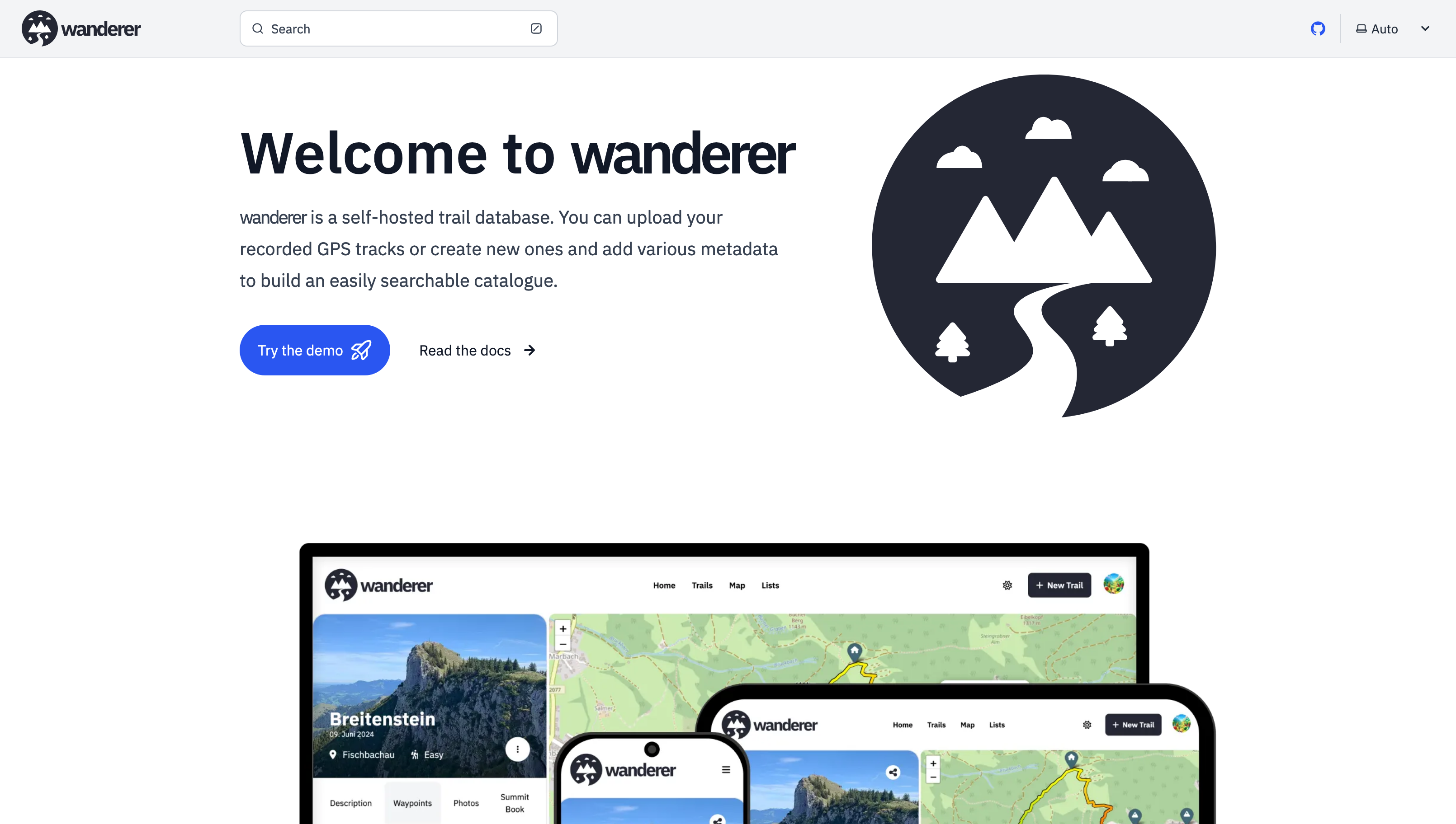
Most importantly there is now a working demo alongside a shiny new landing page.
And here are some more fun features I added since then:
Trail drawing: in addition to uploading you GPX, TCX or KML files, you can now also simply draw a trail by defining multiple waypoints. The route between them will be calculated automatically.
Sharing trails: simple and straightforward - you can share your trails with other users and let them view or edit.
Printing trails: there is now a dedicated print view. Plan your adventure digitally and then take it with you on paper.
wanderer is now available in 8 different languages (thanks to translators from the community). If you would like to contribute a translation you can do so here.
You can now bulk upload multiple trails at once simply by putting them in a dedicated auto-upload folder
And much more. I’d be happy if you give it a try in case you haven’t yet.
Ah, ok, so I can export my OsmAnd paths, import into this and then remind myself of where I went on holiday / almost fell of a cliff / got lost driving / etc ?
I have a bunch of tracks I’ve saved over the years… hmm… maybe this is what I should be using
Looks like what I wanted! However, it doesn’t seem to let me export to a supported format for Wanderer (only kmz?), could you confirm @get_flomped@lemmy.world ?
Open Tracks allows exporting in either KMZ (default), KML or GPX format. Go to Settings, tap on “Import and Export” and there look, towards the end, for the entry “Export/sharing file format”.
You are not logged in. However you can subscribe from another Fediverse account, for example Lemmy or Mastodon. To do this, paste the following into the search field of your instance: !selfhosted@lemmy.world
A place to share alternatives to popular online services that can be self-hosted without giving up privacy or locking you into a service you don’t control.
Rules:
Be civil: we’re here to support and learn from one another. Insults won’t be tolerated. Flame wars are frowned upon.
No spam posting.
Posts have to be centered around self-hosting. There are other communities for discussing hardware or home computing. If it’s not obvious why your post topic revolves around selfhosting, please include details to make it clear.
Don’t duplicate the full text of your blog or github here. Just post the link for folks to click.
Submission headline should match the article title (don’t cherry-pick information from the title to fit your agenda).
No trolling.
Resources:
selfh.st Newsletter and index of selfhosted software and apps


I’ll install this on my Lab it looks cool!
Also, is there any mobile app that can trace and upload trails I do in the day ?
Cool! I always recommend OsmAnd.
Ah, ok, so I can export my OsmAnd paths, import into this and then remind myself of where I went on holiday / almost fell of a cliff / got lost driving / etc ?
I have a bunch of tracks I’ve saved over the years… hmm… maybe this is what I should be using
Exactly! As long as you have the track in a GPX, TCX or KML file, you are good to go.
You can also plan your route directly on wanderer (so you don’t fall off another cliff ;))
On iOS there is GPX Tracker which simply records a GPX track and can overlay openstreetmap data while doing so.
OpenTracks?
Looks like what I wanted! However, it doesn’t seem to let me export to a supported format for Wanderer (only kmz?), could you confirm @get_flomped@lemmy.world ?
I don’t know the app. But on the linked page it says it supports GPX and KML. Both of which wanderer supports.
Open Tracks allows exporting in either KMZ (default), KML or GPX format. Go to Settings, tap on “Import and Export” and there look, towards the end, for the entry “Export/sharing file format”.
Awesome, thanks for the tip! I’ll try the app on my next trail trip